How to use this surf report
Live conditions for Oahu surf spots on all four sides of the island, refreshed every hour, with a spoken report twice a day, the National Weather Service outlook, live wave buoys, an animated swell map, a wave chart running 3 days back and 5 days ahead, and an hour-by-hour wind chart. Every spot card adds a 5-day forecast, why it is or isn’t working, lifeguard and hazard notes and lineup shots from local surfers, and opens a page of its own with more detail. Surf sizes are Surfline’s spot-by-spot estimate, with the official National Weather Service shore forecast alongside as the cross-check. Tap a heading to open it — they follow the page from top to bottom:
At the top
- Wave scale — Face / Hawaiian — Surfline and the National Weather Service report the full height of the wave face. Locals call it in Hawaiian scale, about half of that. The switch changes every surf height on the page — spot cards, featured spot, the four-shore outlook table and the wave chart — and remembers your choice. Buoy readings and the swell map stay as they are: those are open-ocean heights, not surf heights.
- Your level — Beginner / Intermediate / Advanced — rates every spot for how you surf. Advanced is Surfline’s own rating. Intermediate likes 2–6 ft and drops a step for every foot bigger; Beginner wants 1–3 ft and clean wind, whatever Surfline says, and spots that are too hard for you (shallow reef, heavy shorebreak) show Poor or Very Poor with the reason under the size. The rating badges, the 5-day boxes, the map pins, the Conditions sort and Best spots all switch with it, and it’s remembered on this device. Changing it asks you to confirm, with a safety note (tick Don’t show this again to skip that next time); the same check appears in Surf Report Setup on your account. What’s my level? next to the switch opens the Surf levels page: how each level is defined and scored, and which spots suit it. Not for beginners today: any spot with faces over 8 ft, or on a shore under a High Surf Advisory or Warning, gets a red stay-out line on its card for everyone and is Very Poor for beginners.
- “Live feed delayed” note — conditions update every hour. If a gold note appears under the title, our feed has been quiet for more than three hours and the numbers below are older than usual.
- Section bar — the four tabs under the title jump through the page: Report (featured spot and the audio report), Spots (the spot cards), Forecast (wave chart, warnings and the outlook) and Conditions (tide, buoys and wind). Tap one and the page glides there; the bar stays at the top while you scroll and the tab you’re in turns gold.
Today’s report
- Daily photo/video — when a shot or clip of the day is posted it leads the card; otherwise the Featured Spot takes that space. A sponsor card from one of our partners may appear after the audio report, podcast buttons and All reports.
- Featured spot — the standout spot right now, with its size, rating, wind and swell. The size follows the same rule as the spot cards. Under the numbers is the best window: when to go, worked out every hour from Surfline’s hourly wind and rating forecast for that spot — for example “Cleanest 6–8 AM, before the trades fill in”. It only looks at daylight hours still ahead, switches to tomorrow in the evening, and says so plainly when there is no clean window. Some days a hand-written summary replaces it. The gold button at the bottom opens that spot’s full page.
- Daily audio report — a spoken surf report made fresh twice a day, around 6 AM and 12 PM Hawaii time; the note by the date (“Updated 6:01 AM HST”) tells you which edition you’re hearing. It covers ocean warnings, sunrise and sunset, the tide, the wind on each shore, the key spots, the best bet of the day and what’s coming next (from the National Weather Service outlook). Spot sizes come from the National Weather Service shore forecast when it’s current, with Surfline’s estimate for the exact spot as the check. Heights in the audio are always wave-face heights. Under the player, Transcript shows the words, Episodes plays any earlier report and Follow subscribes on Apple Podcasts or Spotify.
- Evening report — Tomorrow's forecast — every evening a third report comes out: a quick look at all four shores, then tomorrow’s sunrise, tides, dawn wind on each shore, each shore’s size (and whether it’s bigger or smaller than today) and the dawn patrol pick. Once it’s posted the player plays it first; the Morning report button underneath switches back to that day’s report.
- Player controls — the blue button plays and pauses, tap anywhere on the progress bar to jump, and the circled “10” buttons skip back or ahead ten seconds. If you’ve been here before, the latest report may start on its own — pause it any time.
- Read today’s report — the full text of the audio report, folded away under the player. Tap it to open. Pick an older day under All reports and the text switches to that day.
- All reports — opens the last 7 days of reports. Tap a row’s round button to play it (tap again to pause); the newest carries a yellow “Latest” badge, and “Back to latest” returns the player to today.
- Podcast & notifications — the same daily report is a free podcast. Tap Follow on Apple Podcasts or Spotify under the player, follow the show, and your phone gets a notification every time a new report goes out — handy on the drive to the beach. Watch on Apple Podcasts opens Surf Chronic Sessions, our video show filmed at the spots on the good days. Every app, plus our Surf Chronic Sessions video show, is on the podcast page.
Surf right now & Best spots
- Surf on Oahu right now — the line above Best spots gives every shore’s surf height in one sentence, with the time it was updated and where the numbers come from (the National Weather Service shore forecast, or Surfline when that forecast is out of date).
- Best spots — next 5 days — the three best mornings (6–noon) or afternoons (noon–6) of the next 5 days across the spots for your level, one per spot, best first (gold outline). The title says who it’s for (and names the day when all three fall on it, e.g. “tomorrow”), and the badge on the right shows the level (Beginner, Intermediate or Advanced). Wind breaks a tie: offshore and light beats onshore, and sooner beats later. Tap one to jump to that spot’s card. Conditions change fast: when in doubt, don’t go out, and check with the lifeguards. How levels work under the list opens the Surf levels page.
- Best spots today / tomorrow ★ Ohana Pass — under the top 3: every spot worth surfing for your level, ranked, with its best 3–5 daylight hours, size, rating, wind, tide and swell, and a Why line (the reason for your level’s rating, whether the size and tide suit that spot). Skip lists the rest with the reason. It opens on Today until 5 PM, then on Tomorrow, so you can plan the night before; tap Today or Tomorrow to switch. The report shows the top spot; See all opens the Best spots page (surfchronic.com/daspot/) with every spot and level for Ohana members.
Shore check
- What it is — one box per shore (North, West, South, East) above the spot cards that puts every source side by side, so you can see at a glance whether they agree before you drive.
- Surfline — the range across that shore’s spots from Surfline’s computer model.
- NWS forecast — the National Weather Service forecaster’s range for the whole shore.
- Open-ocean buoy — swell measured out at sea that’s heading for that shore, and roughly when it arrives. It’s open-ocean swell, not the size at the beach.
- Surfers — what people in the water reported in the last 3 hours (better, as forecast or worse, and how crowded), added up from How’s your session? on the spot cards.
- ✓ Agree / △ Disagree — Agree means Surfline and the NWS ranges overlap. Disagree means they don’t, so lean on the surfer reports and the latest photo. The line under the numbers sums it up in plain words.
- Latest look — the newest approved lineup photo or video from that shore in the last 3 days, with how old it is. Tap it to open that spot (its card in List view, or the spot on the map in Map view). No recent shot? Tap the line to share one.
Spot cards
- ⚠ Not for beginners today — a red line on a spot’s card, its page and its map pop-up when the faces are over 8 ft (Surfline or the National Weather Service, whichever is bigger) or a High Surf Advisory or Warning covers that shore. Everyone sees it, whatever level is picked. If you’re a beginner, don’t go out there: it rates Very Poor for beginners and never shows in their Best spots, until the surf drops or the advisory ends.
- List or Map — Map puts every spot on the island as a pin: surf size, then an arrow showing where the wind is blowing and its speed in mph. Pin colour = the rating for your level. Tap a pin for wind, swell, the reason and Full forecast; Whole island zooms back out. The shore tabs and Edit spots decide which pins show (Edit spots opens its list above the map). Go to surf spot and the Shore check photos open that spot on the map while it’s showing.
- Go to surf spot — the gold pull-down above the tabs jumps straight to any spot’s card, grouped by shore, so you don’t have to scroll. It briefly outlines the card in gold so you can spot it. On a phone or a computer it floats under the section bar while you scroll through the cards, so you can jump again from anywhere.
- Shore tabs — filter by North Shore, West Side, South Shore or East Side. North and west fire in winter, south in summer, and the east side runs on trade wind swell.
- Sort — in List view, the row under the List | Map switch reorders the cards (it hides on the map): Conditions puts the best-rated spots first, Wave size the biggest, and Wind the offshore spots first (then cross-shore, then onshore, lightest wind first). Tap the lit button again to go back to the normal order. It works with the shore tabs and is remembered on your device.
- Compare — tap ⇄ Compare on the Sort row, then + Compare on two spot cards (two at most; untick one to swap). Without an Ohana Pass, the second pick puts the two cards side by side (one above the other on a phone) and hides the rest until you untick one or tap ×. Which is better? (Ohana Pass; try it free 3 times) opens the full comparison: the better call for your level right now and why, then rating, wave size, wind, swell, tide, best window and every stat from the spot guide, with the winner of each row marked and a medal on the spot with more of them.
- Rating badge — overall quality for each spot, on the same scale and in the same colours as Surfline, so it reads the way you already know it (at Advanced it is Surfline’s own rating; pick Beginner or Intermediate at the top and it re-rates for you, with the reason in gold under the size): Very Poor Poor Poor to Fair Fair Fair to Good Good Epic. The rating is Surfline’s, for that exact spot.
- Surf size — height in feet, shown in whichever wave scale you picked at the top. The big number is Surfline’s estimate for the exact spot; the National Weather Service shore forecast sits under it as the cross-check (✓ agree within a foot, △ disagree). If the NWS product is missing or a day old the cards fall back to Surfline.
- Wind & gusts — in miles per hour, and whether it’s Offshore (clean), Cross-shore, or Onshore (choppy) for that particular spot.
- Swell — height @ period in seconds, and the direction it comes from. Longer periods (14s and up) mean more powerful, better-organised waves. We only credit a spot with swell that can actually reach it: “wind swell” marks short-period chop from the trades, “wrapping in” means it comes from another side of the island and only bends into the spot, and “No north swell” means just that — it’s flat for a reason.
- Updated time — each card shows when its conditions were last fetched. If Surfline doesn’t answer for a spot, the card keeps its last good numbers and the time turns yellow (“Last updated 7:00 PM · not current”) until the next hourly update gets through. If Surfline stays down for more than three hours the card switches to backup data (“Updated 9:00 PM · backup data”): surf size from the University of Hawai‘i’s SWAN wave model at that spot (the SWAN tag), scaled by how it compared with Surfline there over the last week, or the National Weather Service shore range; wind from the National Weather Service (no gusts); swell from the buoys; and a rating we estimate from the spot’s size range and the wind, which lands within one step of Surfline’s nine times out of ten.
- Wave heights — next 5 days — in its own outlined box with a blue Wave heights badge: a box for each morning (6 AM–noon) and afternoon (noon–6 PM), today and the next four days, from Surfline’s forecast for that spot. The number is the surf size (it follows the Face / Hawaiian switch). The three bars under it are in the rating colour, the same as the badge, and their shape shows where the surf is heading: short to tall = rising, level = steady, tall to short = dropping. A solid gold ring marks a half-day rated Good or better; a yellow-to-green ring marks Fair to Good — it could turn good, but conditions change, so it’s a heads-up rather than a promise. Tap How to read this forecast under the boxes for a pop-up card with examples and the full colour key.
- Tide · next 12 h — under the wave heights: a circle with the tide height now and an arrow (up = rising, down = falling), then the next 12 hours of the Honolulu tide curve with its highs (H) and lows (L). Tap it for the full tide chart.
- Wind · next 12 h — under the wave heights: a circle with the wind speed and an arrow for its direction (ring colour = offshore, cross-shore or onshore for that spot), then the next 12 hours as coloured bars. Tap it for the full wind chart.
- Why it’s working (or not) — the boxed line checks the swell, size, wind and tide against what that spot likes, for example “NNW swell in its window, good size, offshore wind; but high tide now, better tide from 1 PM”. The coloured strip across the top gives the verdict at a glance: Working (green, everything lines up), Partly working (yellow, something’s off — often the wind or the tide) or Not working (grey-blue, wrong swell or size today).
- Safety — whether the lifeguard tower is staffed right now (towers run 8 AM–6:30 PM) or where the nearest one is, the spot’s hazards, any National Weather Service alert for that shore, and a link to the official hazard rating for the closest guarded beach.
- Lineup photos & video — shots from local surfers, checked by us before they go up. The newest one leads its spot’s card with a “Lineup · 2 hours ago” label and the surfer’s Instagram or YouTube credit; tap the name to see their page. Upright phone shots are shown whole, not cropped. Videos have a Full screen button that plays them big with sound; for photos, tap the photo or Full screen to see it full size, then tap anywhere or × to close. A card with no shot yet invites you to be the first. Shots stay up until the next morning report (6:00 AM) or until a newer one comes in. Each spot’s page keeps its latest 3 shots; when there are more, See <spot> gallery opens a page with every approved shot of that spot, newest first.
- Show more — each card starts short: photo or video, Add your lineup, the rating and wave size. Tap Show more for tide, weather, wind, swell, the 5-day heights, the tide and wind strips, why it’s working, lifeguards and surfer reports. Picking a spot from Go to surf spot opens it.
- 📷 Add your <spot> lineup — the solid orange button under each card’s photo or video (and on the spot page) opens the upload form with that spot already picked; you can say how your session was in the same form.
- Surfed today? — tap the gold card or Upload to share your photo or clip with the Surf Chronic Ohana. Pick the spot and add your Instagram or YouTube name for credit. To be approved it has to be from today, clear, and show the surf.
- Share <spot> with your crew (the orange-outlined button at the bottom of each card; “Share with your crew” on a phone) — sends the spot’s live numbers and a link to your crew. On a phone it opens your share sheet (Messages, Instagram, WhatsApp…); on a computer pick Facebook, X, Threads, WhatsApp, text, email or copy. The link preview shows that spot’s size and rating with its lineup shot or a spot card. The blue button beside it opens the spot’s page and 11-day forecast.
- 🔔 Alerts — the bell on each card and spot page opens your surf alerts for that spot: wave height, Good conditions, offshore wind, the tide you like and new lineup photos, by email or a notification on your phone. Ohana members can also build custom alerts for that spot from swell size, period and direction, wind and tide, starting from the spot’s ideal conditions. It turns yellow and says ON when your alerts cover that spot.
- Reports from the water — surfing or just checked it? Answer How’s your session? when you upload a lineup shot, or tap Be the first to say how it is on a spot card: better, as forecast or worse than the forecast, and how crowded. Each card shows what surfers said in the last 3 hours, so you know whether the numbers match what’s really happening, and the Shore check adds them up for each shore.
- ★ My spots & Edit spots (Ohana Pass) — members tap the star on a card to pin that spot to the top and to a My spots tab, and use Edit spots to untick the spots they don’t want to see (Hide all and Show all do the lot at once). Both are saved to their account on every device. Join the Ohana to turn it on.
Spot pages
- A page for every spot — tap the blue 11-day forecast button on a card. Each page has the live numbers and lineup shot, the forecast (5 days, or all 11 with the Ohana Pass) and the swells in the water, when the spot works best (swell direction, size and tide), wind for that shore, the tide, the nearest buoy and any swell on its way, safety, a satellite map with directions in Apple or Google Maps, our guide to the spot, its lineup gallery, videos and the other spots on that shore.
- Right now card — the live numbers, the Wind · next 12 h strip (tap it to jump down to that spot’s 36-hour wind chart), why it’s working or not, the surfer reports, and the Add your lineup and Share buttons. The wind chart’s All spots › button opens the report’s wind card on this spot, to compare it with the rest.
- Getting around a spot page — the bar at the very top jumps to the other spots on that shore (the dot is each spot’s rating colour) or back to all of Oahu. Right under it, the section bar has four tabs: Now (the live card), Forecast (the forecast and when it works), Conditions (wind, tide and buoys) and Guide (safety, map, ideal conditions, the spot guide, videos and photos). Tap one to jump there; the bar stays at the top while you scroll and the tab you’re in turns gold.
- 11-day forecast (Ohana Pass) — the same boxes as the cards (size, rating-coloured bars that rise, hold or drop, gold and yellow-to-green rings) for 11 days, with the wind under each box as speed / gust in mph, coloured by direction for that spot: green offshore (clean), yellow cross-shore, orange onshore (choppy). The colour key sits right under the table. Days 8–11 are a long-range outlook and change more. Without the Ohana Pass you see the first 5 days and the rest stays locked; members also get the wave chart 11 days out.
- Tap a day in the forecast to open it: the best window for your level (the best 3–5 daylight hours, scored on the rating, the wind and the spot’s favourite tide) with its size, wind and tide; then hour by hour from 6 AM to 6 PM — surf height as a bar in the rating colour, wind speed with an arrow showing where it blows (outlined hours = the best window) — and that day’s tide chart. Tap the day again or × to close it.
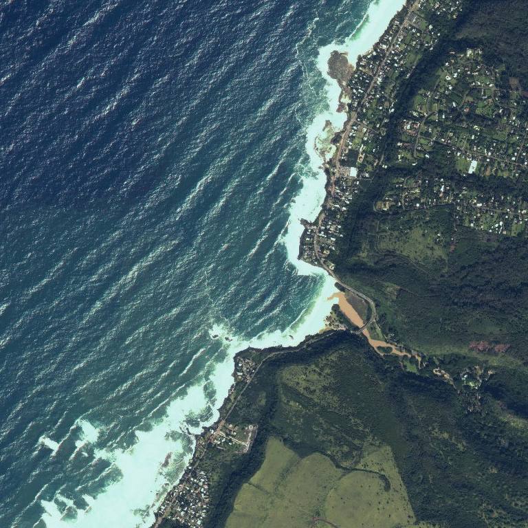
- Swell direction map — by the buoys under Conditions: a satellite view of the spot with a compass on top. Each coloured wedge points where a swell is coming from (longer = bigger, gold = the strongest), matched to the list beside it, and the white arrow shows how the wind is blowing right now.
- Ideal conditions — the swell direction, wind, surf height and tide that make the spot fire.
- Map buttons — ≋ Reef lays the NOAA nautical chart over the satellite photo: depths in feet, reef and rock areas and channels (a guide, not for navigation). ◎ Me shows where you are (your phone asks first; your location stays on your phone) and how far you are from the spot, or the drive time to the parking on the Apple map. ⛶ Full screen opens the map big.
- Lineup photos & video — the spot’s latest shots from local surfers; See <spot> gallery opens all of them (24 a page, Newer / Older to page through).
- Videos — under the lineup photos on some spots: clips of the spot from YouTube or from us, each with its filmer credited under it.
- Spot guide — ability level (beginner, intermediate, advanced), then five bars, each with a short note: local vibe (welcoming → intimidating), crowd (mellow → heavy), spot rating (poor → perfect), shoulder burn (how hard the paddle is, light → exhausting) and water quality (clean → dirty). Below them: hazards, what board to bring, access & parking, the bottom and the best season.
- Bookmark it — save your break’s page to your home screen; it’s always the live report for that spot. Shared spot links open straight to the page.
Wave chart & swell map
- Swell map — wave height in the ocean around Oahu from the University of Hawai‘i’s PacIOOS wave model, which resolves the island down to about 500 metres. Colours follow the same scale as Surfline’s wave-height map, with the legend in feet under the map: navy and blue are small, green 5–6 ft, yellow 8, orange 10, red 15 and up. It shows what is arriving offshore — the surf at each break depends on how that swell meets the reef. The model runs about six days ahead; slide past that and the map fades with a note. Use + and − to zoom.
- Oahu / All islands — the switch above the map changes the view. Oahu is the close-up (about 500 m detail). All islands shows Niihau and Kauai through Maui to the Big Island from PacIOOS’s WaveWatch III Hawai‘i model (about 5 km detail), so you can watch a swell reach each island and see the calmer water in each island’s shadow. Same colours, slider and play button; your choice is remembered next time.
- Wave height chart — surf heights for the key spots: the last 3 days left of the dashed NOW line (our own hourly record) and the next 5 days to the right (11 with the Ohana Pass). These lines are Surfline’s forecast for each exact spot — the National Weather Service only forecasts two days, and only per shore — so a line can sit a foot or so off the shore number on the spot cards. The chips under the chart show each spot’s size at the selected moment; tap a chip to hide or show its line.
- Time slider & play button — one slider moves the chart and the map together in 3-hour steps; tapping the chart jumps there too. The round button plays the whole timeline. Press play on the audio report and the forecast animates along with it, starting from now. Touch the slider and it stops.
Warnings & outlook
- Ocean warnings — advisories in effect for Oahu only: high surf, wind, small craft, flooding, brown water and sewage spills. Red is a Warning (most serious), yellow is an Advisory or Watch, and green means nothing is in effect. Weather warnings come from the National Weather Service; brown water and sewage notices come from the Hawai‘i Department of Health, each with the date it was posted or last updated. Brown water notices drop off 36 hours after the state last issued them.
- First visit free — the first time you open the report you see all of it, no email needed. After that we ask for an email (free) to keep reading; Ohana members just log in.
- Open during warnings — while a High Surf, Hurricane, Tropical Storm or other ocean warning is in effect for Oahu, the whole report opens to everyone, no email needed, with a red note at the top saying why. Watches and advisories don’t open it.
- Surf outlook — straight from the National Weather Service forecasters in Honolulu: their own write-up of what’s coming, above a table of expected face heights for the north, west, south and east shores, morning and afternoon, for the two days they publish. It’s refreshed each time they issue a new forecast, usually twice a day, and it’s the quickest way to see a new swell on the way. The height colours are Surfline’s rating for that shore, the average of its spots for that half-day: orange poor, yellow poor to fair, green fair, teal good and purple very good to epic. Hover or press a number to see the rating.
Tide
- Tide chart — today’s tide curve for Honolulu. Dark blue dots are high tides, white dots are low tides, and the white “NOW” marker is the current level. Tap the “Full Tide Chart” badge on the tide card (here and on every spot page) for the monthly tide calendar.
- Sunrise & sunset — the sun chip gives today’s sunrise and sunset times, and the chart is shaded darker for the hours before sunrise and after sunset.
- King tide — a gold dot and flag mark unusually high tides (2.5 ft and up). Expect higher-than-normal water levels and some shoreline flooding.
- Moon cycle — the moon chip shows the current phase, how lit it is, and the date of the next full moon (tides follow the moon).
- UV index — the day’s peak UV for Honolulu and when it hits, coloured from green (low) to purple (extreme). At 8 and up you burn in well under half an hour; reef-safe sunscreen and a rash guard help.
- Box jellyfish warning — a gold banner appears 8–10 days after each full moon, when box jellyfish typically reach south- and west-facing beaches.
Forecast accuracy
- Our scorecard — every hour we write down what the PacIOOS SWAN model and Surfline say a buoy will read 24 hours later, then check it against what the buoy actually measured. “0.6 ft off on average” is the typical miss over the last 30 days, “82% within 1 ft” how often the forecast was close enough to plan on, and “runs high / low” which way it leans. The better model on each buoy is outlined in green. Open-ocean heights, not surf heights — and nobody edits the numbers.
Wave buoys
- Measured right now — live readings from the buoys off Waimea Bay (north), Mokapu Point (east) and Barbers Point (south), updated every half hour: total wave height, period and direction, the long-period swell split from local wind waves, water temperature, and a 5-day trend line. A long-period swell climbing on a buoy is the first real sign of new surf, hours before it shows at the beach. A greyed-out buoy is offline.
- Early warning — offshore buoys — NOAA buoys 150–250 miles out in the open ocean (northwest, northeast, west and southwest of the islands). A swell passes them 8–24 hours before it reaches Oahu, so each card says which shore that swell is heading for and roughly when it arrives — longer-period swells travel faster. A gold New swell tag means the height jumped or the period suddenly got longer in the last 6 hours: the classic first sign of a fresh swell (gold card). A blue Incoming card is swell heading our way at a steady size; a faded grey Past Oahu card won’t bring surf. The map shows where each buoy is, with an arrow for the way its swell is travelling and a dashed line to the shore an incoming swell will reach; each card’s compass, the angle it comes from in degrees (0° = north, 90° = east) and the buoy’s latitude/longitude give the exact numbers. Tap the heading to fold the section away. “Past Oahu or heading away” means that buoy’s swell has already gone by the island or is moving away, so it won’t bring surf.
Wind, hour by hour
- Four rows, one per shore — each bar is one hour of forecast wind (height = mph, the number sits on every third bar), from now through tomorrow. Green is offshore (blowing from the land, grooms the waves), yellow cross-shore, orange onshore (choppy). The dashed blue line is midnight. In Hawaii the wind, not the swell, usually decides whether it’s worth going — look for the green stretch on your shore and go then. Hover or tap a bar for the exact hour.
- Pick a spot — the pull-down above the chart shows the forecast for any spot or wind spot on its own, judged by the way that beach faces. All four shores goes back to the four rows.
- List or Map — Map puts a wind circle on each spot, coloured the same way, with an arrow for where the wind blows and the speed in mph; drag the slider to move through the next 36 hours. Tap a circle, or pick from the pull-down, and the map flies there with that spot’s chart below; tap anywhere else to drop a pin and get the National Weather Service forecast for that exact place. Your choice is remembered.
- Wind spots — its own card for Turtle Bay, Kahuku, Backyards (Sunset), Mokuleia, Kaneohe Bay Sandbar, Kalama (Kite Beach), Kailua Beach, Waimanalo (Bellows), Hawaii Kai (Maunalua Bay), Diamond Head Cliffs, Sand Island: the forecast at each beach, judged by the way that beach faces, so the same trade wind can be cross-shore at one and onshore at another.
- On every spot card — “Wind · next 12 h” shows the next 12 hours as small coloured bars and tells you if the wind turns (e.g. cross-shore → offshore). Tap it for the full wind chart, opened on that spot. Spot pages show it too, in the Right now card.
Where the numbers come from
Surf heights: Surfline’s per-spot estimate, with the National Weather Service Honolulu shore forecast as the cross-check. Surf outlook and hourly wind: National Weather Service. Spot wind, swell, rating, tides, the best window and the wave height chart: Surfline; when Surfline is down, the PacIOOS SWAN model, NWS wind, NOAA buoys and tide predictions, and our own rating. Ocean warnings: National Weather Service Honolulu. Brown water and sewage notices: Hawai‘i Department of Health, Clean Water Branch. Buoys: NOAA National Data Buoy Center. Swell map and forecast scorecard: PacIOOS SWAN Oahu wave model, University of Hawai‘i. The official numbers and Surfline’s back each other up, so an outage or a bad model run on either side never takes the report down. Each spot’s swell is cross-checked against the buoys every hour, and a reading that can’t be right is replaced with the nearest spot’s. Next 5 days: Surfline’s surf and rating forecast for each spot. Why-it’s-working line and best conditions: our own spot-by-spot local knowledge. Lifeguard hours: Honolulu Ocean Safety. Hazard ratings: Safe Beach Day (Hawaii Lifeguard Association). UV index: U.S. EPA. Lineup photos and video: local surfers, credited on each shot.
Waimea Bay
Forecast — next 11 days
| TodayNov 7 | SunNov 8 | MonNov 9 | TueNov 10 | WedNov 11 | ThuNov 12 | FriNov 13 | SatNov 14 | SunNov 15 | MonNov 16 | TueNov 17 | |
|---|---|---|---|---|---|---|---|---|---|---|---|
| AM | 5–614/30 mph | 7–912/26 mph | 6–714/29 mph | 8–914/23 mph | 13–1520/22 mph | 3–512/18 mph | 3–512/18 mph | 3–512/18 mph | 3–512/18 mph | 3–512/18 mph | 3–512/18 mph |
| PM | 5–615/27 mph | 7–815/28 mph | 8–918/34 mph | 6–819/21 mph | 15–1821/26 mph | 3–512/18 mph | 3–512/18 mph | 3–512/18 mph | 3–512/18 mph | 3–512/18 mph | 3–512/18 mph |
Tap a day for its best window, hour-by-hour surf and wind, and the tide.
Swells in the water
| From | Height | Period |
|---|---|---|
| ENE 64° | 6.8 ft | 7 s |
| NW 326° | 4.3 ft | 12 s |
| SW 230° | 0.9 ft | 14 s |

When it works
- SwellNW to N
- Size15–50 ft face
- Tideany tide
How Waimea Bay ranks today & tomorrow for your level, with why › ★ Ohana Pass
Wind — next 36 hours
All spots ›Tide today
Full Tide ChartUV & sun safety
- Safe UV 0–2 · before 10 AM and after 2 PM
- Cover up UV 3+ · 10 AM–2 PM — sunscreen, rash guard, hat
- Avoid UV 8+ · 12 PM–2 PM — burns in under 15 minutes, seek shade
Swell & buoys
Swell right now
| 6.8 ft | 7 s | ENE 64° |
| 4.3 ft | 12 s | NW 326° |
| 0.9 ft | 14 s | SW 230° |
Wind 13 mph offshore · white arrow shows how it blows
Buoys — measured
Waimea Bay buoy (NOAA 51201): 6.6 ft at 11 s from the NNW · water 78°F
Safety
Hazards: Heavy shorebreak and strong currents on big days · Hazard rating →
Map & directions
Ideal conditions
NW to N
15–50 ft face
any tide
Lineup photos & video
No lineup shots of Waimea Bay yet.
📷 Add your Waimea Bay lineup🎥 Want your next session filmed in 4K? Book your private capture →